
About
Between Lake Mariout and the desert
The district in brief
El Amreya II is a district in south-western Alexandria, created from El Amreya District by prime minister’s decree 312 of 2015; its limits are those of the El Amreya II police qism. Its northern edge is the International Coastal Road from the Tameer axis bridge at Umm Zighiyu to the Borg El Arab airport roundabout road; its eastern edge is the Dhiraa El Bahari link road from kilometre 29 of the desert road; to the south it reaches kilometre 71.5 of the desert road, as the district’s document, published by Alexandria Governorate, sets it.3
The district holds one qism and six shiakhas: King Mariout, El Hawareya, Naga El Omda Khalil, Naga El Omda Hindawi, El Wadi and Palestine, with some sixty villages, nagaas, ezbas and streets between them, among them old El Nasiriya and Bangar El Sokkar villages 1 to 7.1
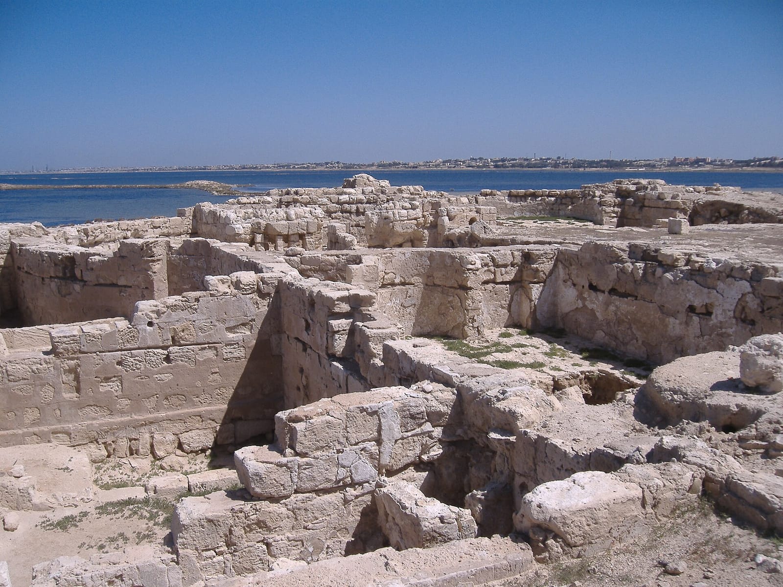
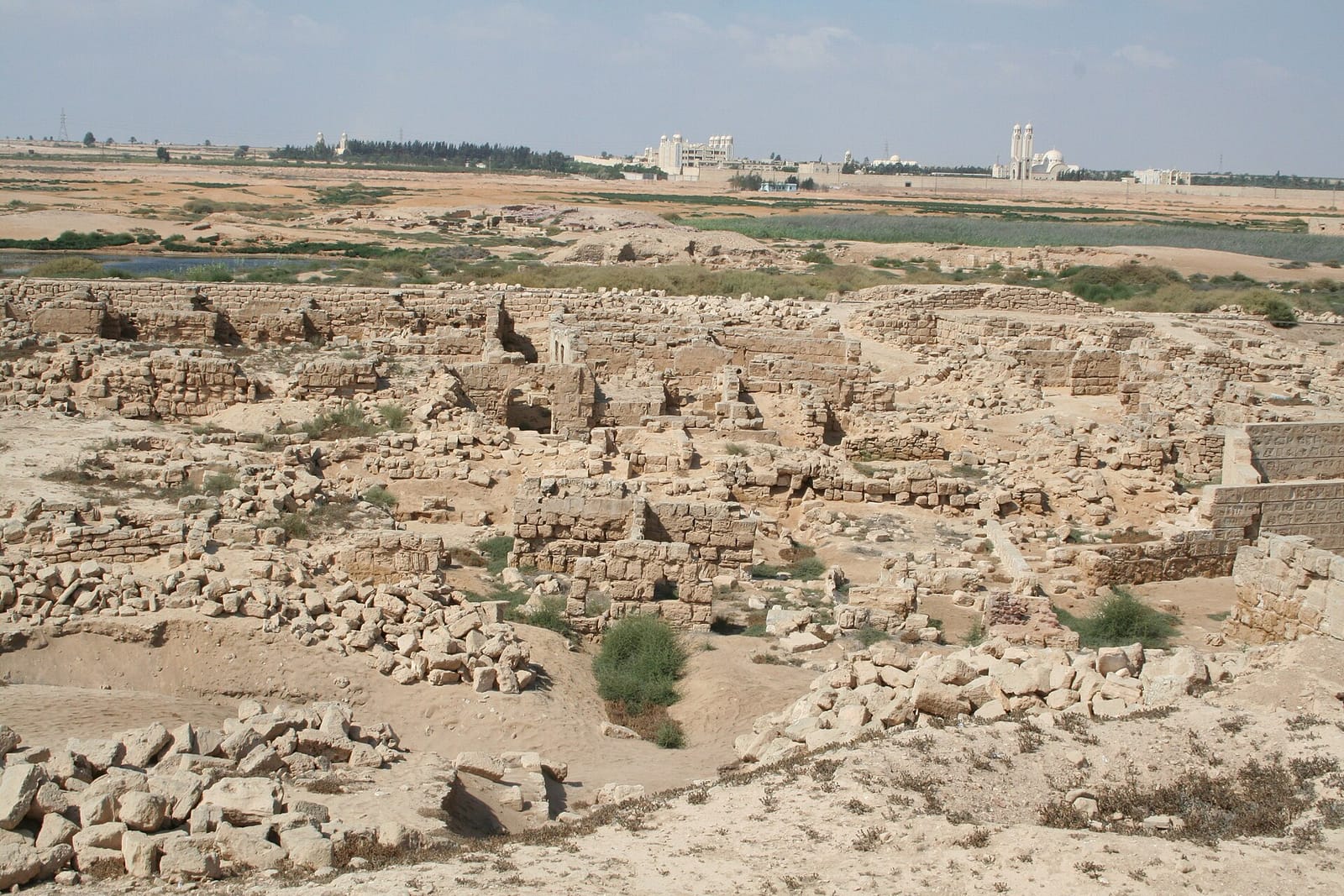
The district headquarters at the entrance of old El Nasiriya and its technology citizen service centre take residents’ requests; call the district on 03 4518000 to confirm before you visit. Within the district are Abu Mena, on the World Heritage List, the Monastery of Saint Mina, the ruins of Marea on Lake Mariout, and Borg El Arab Stadium.
The district at a glance
Our vision for clearer services, protected heritage and a district that welcomes residents and visitors.
A safe, orderly district where every resident, in town and village alike, gets their service easily and clearly, and which keeps its farmland and the antiquities of Abu Mena and Marea.
The qism and its shiakhas
One qism, El Amreya II, holding six shiakhas, each with the villages, nagaas, ezbas and streets the district’s page on the governorate portal lists.
El Amreya II
ثان العامرية
Its six shiakhas: King Mariout, El Hawareya, Naga El Omda Khalil, Naga El Omda Hindawi, El Wadi, Palestine1
- Population, estimate for 20172
- 278,968
King Mariout
كينج مريوط
El Heba Street, Omar El Mokhtar Street, Nagaa El Matarid (north and south), Nagaa Abu El Hol, El Rashidi Street, Nagaa Yadem, old El King Street, Nagaa Waer, Maarouf Street, El Sayed Orabi Street, El Nour Mosque Street, El Kafouri Street, Seven Up Street, El Kablat Street, new El King Street north of the railway, the Presidential Rest House Street, Dr Diodar Street, Nour El Islam Mosque Street, El Salam West4
El Hawareya
الهوارية
the airport road and the Obeida family’s area, Nagaa Habboun (north and south), Nagaa Abu Qarqoura, El Hawareya (south and north)4
Naga El Omda Khalil
نجع العمدة خليل
Nagaa El Saedi, old El Nasiriya, the Nasiriya housing, Nagaa Raslan (north and south), Ezbet Ibrahim Saleh, Ezbet Kahla, Abu Bseisa, Nagaa Hafiz4
Naga El Omda Hindawi
نجع العمدة هنداوي
the villages of Ahmed Orabi, Sheikh Mustafa Ismail, El Maabad, Mahmoud Shaltout, Othman Ibn Affan, Sitta Dawagen, Abdel Rahman Basarek 58, El Saeda, Aleppo, El Horreya, El Galaa, Abu Masoud, Khaled Ibn El Walid, 59, El Gazayer and Abu Bseisa4
The district’s Map page also lists Sheikh Mustafa Ismail village as a seventh shiakha; the 2016 boundary document has six.
El Wadi
الوادي
Ezbet Ard El Saayda, El Wadi, Ezbet Mansour4
Palestine
فلسطين
Nagaa Abu Siam, the villages of Baghdad, Basra, Mustafa Kamel, Abu Bakr El Seddiq, Iraq and Yemen, Bangar El Sokkar villages 1 to 7, Nagaa Kateb, Palestine village, Nagaa Rahim4
The higher-numbered Bangar El Sokkar villages are served by Borg El Arab; road 16 of Bangar El Sokkar is the line between the qism and the Borg El Arab police qism.
The population figure is CAPMAS’s estimate for the whole qism; no figure is published per shiakha. The map’s lines are approximate: CAPMAS’s data draws three shapes for the six shiakhas, King Mariout, El Hawareya, and a “Mariout sector” that holds the other four.
Timeline
The martyr Menas
AD 296
Menas of Alexandria died a martyr in AD 296; over his tomb grew the early Christian holy city of Abu Mena, with its church, basilicas, monasteries, houses and workshops.
The pilgrimage city
5th to 7th century AD
Abu Mena, as UNESCO describes it, shows the growth of an early Christian pilgrimage centre from the 5th to the 7th century AD. On the south shore of Lake Mariout, Marea was an ancient port, with a basilica from the 5th century.
Abu Mena found
1905
The German archaeologist Kaufmann found the site of Abu Mena in 1905.
The Monastery of Saint Mina
1959
Pope Kyrillos VI laid the foundation stone of the Monastery of Saint Mina at Mariout on 27 November 1959, beside the ancient site of Abu Mena.
World Heritage
1979
UNESCO inscribed Abu Mena on the World Heritage List in 1979, and on the List of World Heritage in Danger in 2001.
The El Amreya II police qism
2007
Interior Minister’s decision 966 of 2007 created the El Amreya II police qism, whose limits later became the district’s. Borg El Arab Stadium opened the same year.
A new district
2015
Prime minister’s decree 312 of 2015 (14 February 2015) created El Amreya II District out of El Amreya District, which was renamed El Amreya I.
The shiakhas’ boundaries
2016
In January 2016 Alexandria Governorate published El Amreya II District’s document: its qism, its six shiakhas and the limits of each, among them the newly created El Wadi and Palestine.
Off the danger list
2025
In July 2025 Abu Mena was removed from the List of World Heritage in Danger.
Our priorities
Four commitments that govern the district’s day-to-day decisions.
Automated, understandable service
Residents should know the documents their service needs before they visit the technology centre, and find reconciliation files, licences and complaints handled in one place.
Licensed shops
Following up shops and workshops on the desert road, the Kafouri road, in El Nasiriya and in the villages, and warning unlicensed ones to put their papers in order.
Protected land
Stopping unlicensed building and encroachments on farmland and state land before they are finished, in King Mariout, El Hawareya and the villages.
Villages served
Following up drinking water, road paving and medical and cultural convoys in the villages and nagaas, and receiving residents’ complaints at the district headquarters.
Sources
- 1Alexandria Governorate: El Amreya II District, its divisions and the boundaries of its shiakhas (January 2016) (opens in a new tab).
- 2CAPMAS: population estimates for 1 July 2017 (opens in a new tab), page 16.
- 3Prime minister’s decree 312 of 2015, Official Gazette no. 11 of 12 March 2015 (opens in a new tab).
- 4Alexandria Governorate: El Amreya II District, the district map and its divisions (August 2020) (opens in a new tab).